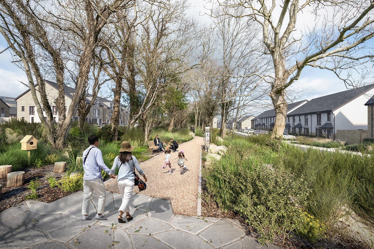
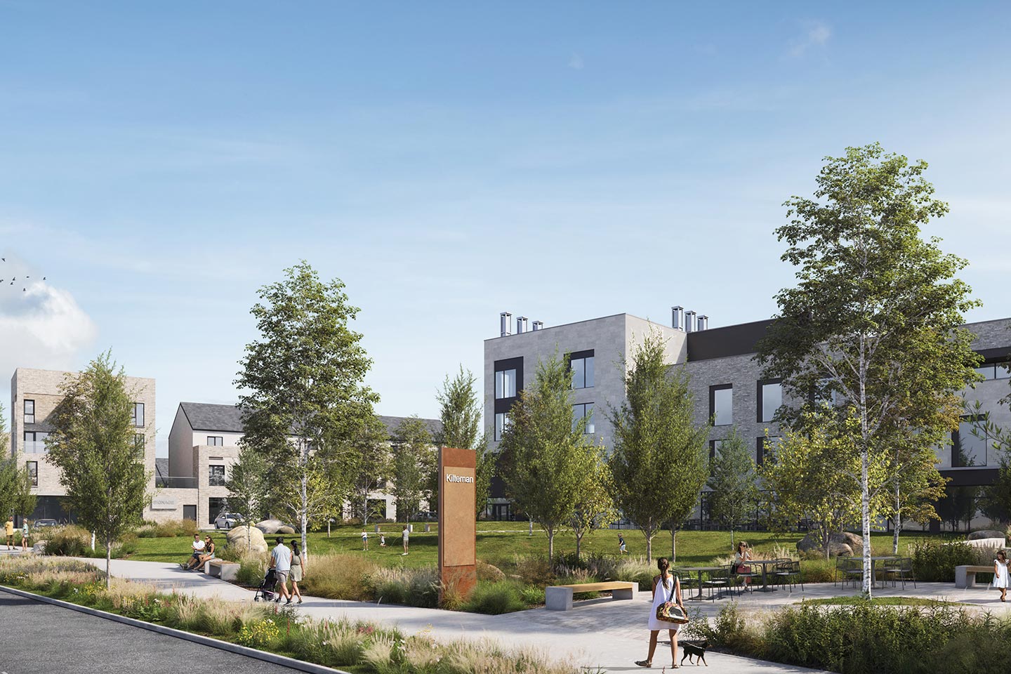
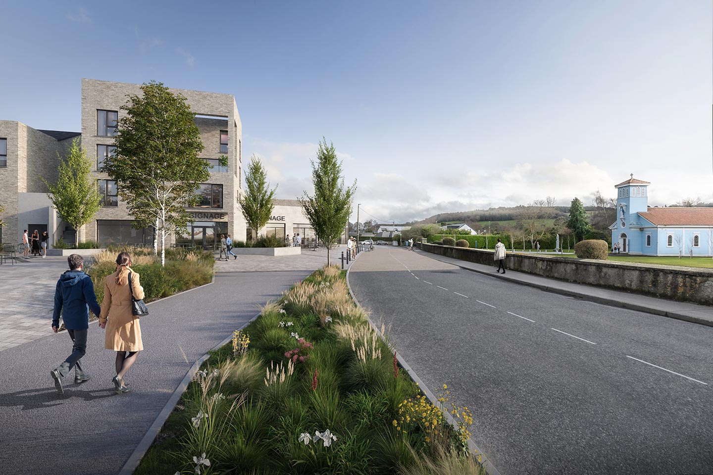
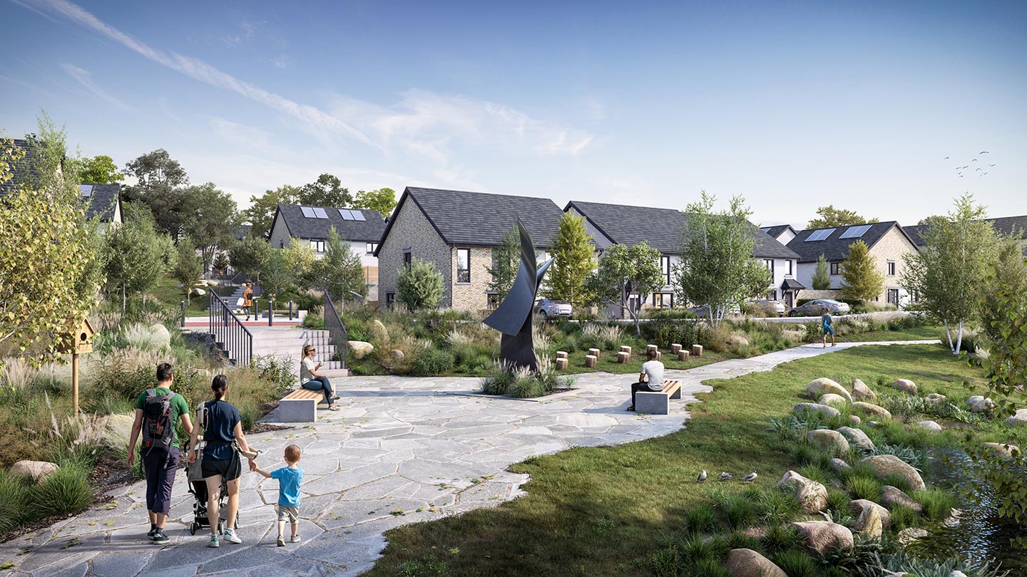
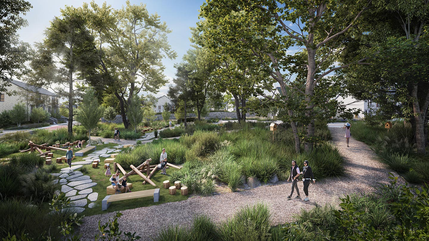
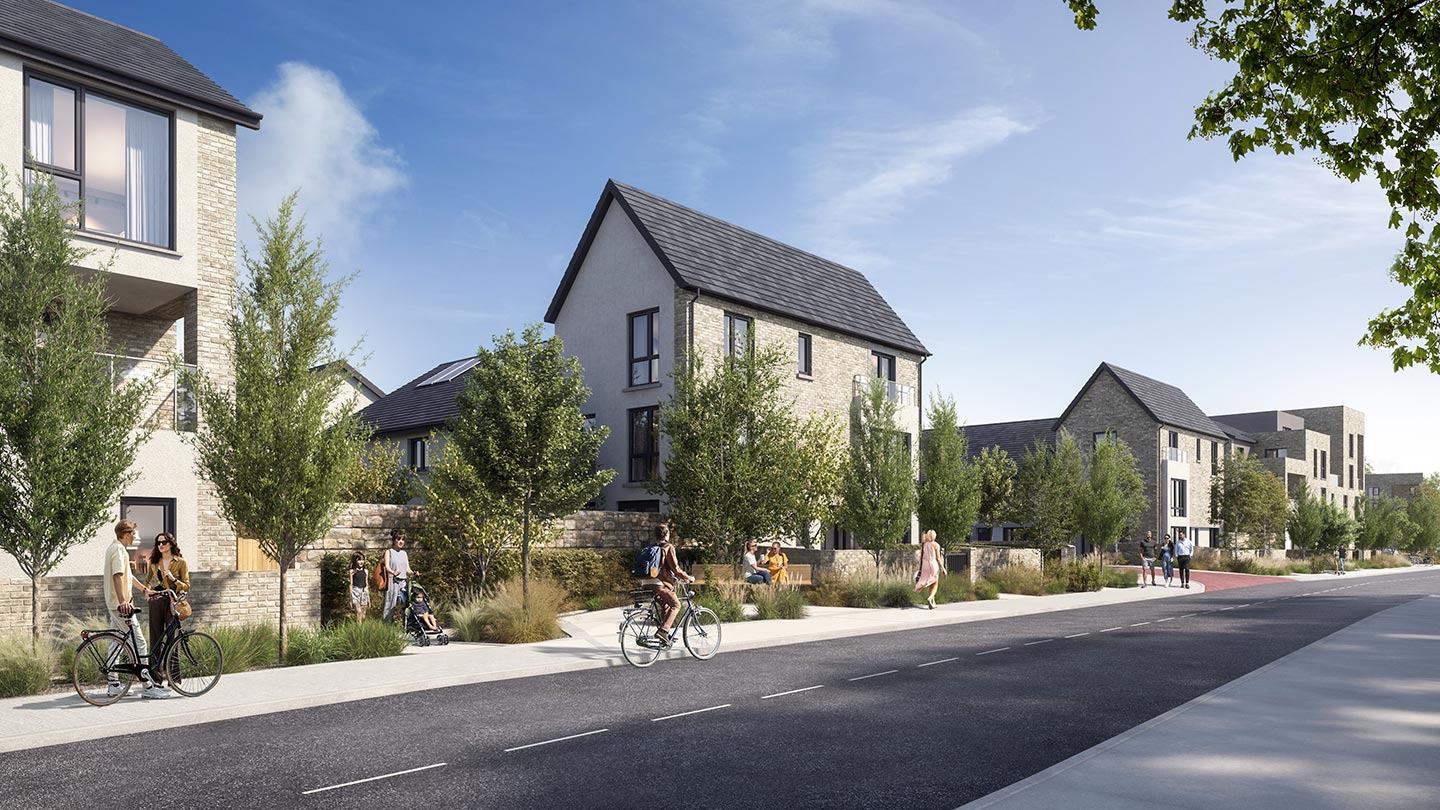
Liscove Limited intend to apply for permission for a Large-Scale Residential Development on 2 No. sites, measuring c. 14.2 Ha., which will be separated by the future Glenamuck Link Distributor Road (GLDR). The western site principally comprises lands at Wayside, Enniskerry Road and Glenamuck Road, Kilternan, Dublin 18, which include a derelict dwelling known as ‘Rockville’ and associated derelict outbuildings, Enniskerry Road, Kilternan, Dublin 18, D18 Y199 and the former Kilternan Country Market, Enniskerry Road, Kilternan, Dublin 18, D18 PK09. The western site is generally bounded by the Glenamuck Road to the north; the Sancta Maria property to the north, west and south; a residential development named "Rockville" to the north-east; the Enniskerry Road to the south-west; dwellings to the south; and the future GLDR to the east. The eastern site is generally bound by dwellings to the south; the future GLDR to the west; and greenfield land to the north and east. Road works are proposed to facilitate access to the development from the Enniskerry Road; to the approved Part 8 Enniskerry Road/Glenamuck Road Junction Upgrade Scheme on Glenamuck Road (DLRCC Part 8 Ref. PC/IC/01/17); and to the approved Glenamuck District Roads Scheme (GDRS) (ABP Ref. HA06D.303945) on the Glenamuck Link Distributor Road (GLDR). Drainage and potable water infrastructure is proposed to connect to services on the Glenamuck Road, Enniskerry Road and the GLDR. The Glenamuck Road access point will include works, inclusive of any necessary tie-ins, to the footpath and cycle track to create a side road access junction incorporating the provision of an uncontrolled pedestrian crossing across the side road junction on a raised table and the changing of the cycle track to a cycle lane at road level as the cycle facility passes the side road junction. Surface water and foul drainage infrastructure is proposed to connect into the drainage infrastructure to be constructed as part of the Part 8 scheme. Potable water is to be provided from the existing piped infrastructure adjacent to the site along Glenamuck Road. Surface water and foul drainage infrastructure connections for the ‘former Country Market’ area (north-west of the site) are proposed to connect into the drainage infrastructure at the Enniskerry Road/Glenamuck Road junction. The GLDR ‘western’ access point will include works, inclusive of any necessary tie-ins, to the footpath and cycle track to create a side road access junction incorporating the provision of short section of shared path and an uncontrolled shared pedestrian and cyclist crossing across the side road junction on a raised table. The works will also include the provision of a toucan crossing, inclusive of the necessary traffic signal equipment, immediately south of the access point to facilitate pedestrian and cyclist movement across the mainline road. All works at this GLDR access point will include the provision of the necessary tactile paving layouts. Surface water, foul drainage and potable water infrastructure connections are proposed into the drainage infrastructure to be constructed as part of the GDRS scheme. The GLDR ‘eastern’ access point will include works, inclusive of any necessary tie-ins, to the footpath and cycle track to create a side road access junction incorporating the provision of short section of shared path and an uncontrolled shared pedestrian and cyclist crossing across the side road junction on a raised table. Potable water, surface water and foul drainage infrastructure connections for the eastern site are proposed into the drainage infrastructure to be constructed as part of the GLDR. On Enniskerry Road, works are proposed to facilitate 3 No. new accesses for the development along with modifications to Enniskerry Road. The 3 No. side road priority access junctions incorporate the provision of an uncontrolled pedestrian crossing across the side road junction on raised tables. The modifications to Enniskerry Road fronting the development (c. 340 metres) includes the narrowing of the carriageway down to c.6.5 metres (i.e. a c.3.25 metres running lane in each direction) from the front of the kerb on the western side of Enniskerry Road. The remaining former carriageway, which varies in width of c. 2 metres, will be reallocated for other road users and will include the introduction of a widened pedestrian footpath and landscaped buffer on the eastern side of the road adjoining the proposed development. On Enniskerry Road at the interface of the proposed Dingle Way and Enniskerry Road, aligning with the proposed location of the community centre/café and existing Our Lady of Wayside Church, works include the continuation of the Dingle Way surface materials across Enniskerry Road to create a raised table to connect these community facilities. The above works are inclusive of all necessary tie-in works such as new kerbs along the eastern side of Enniskerry Road, drainage details, road marking, signage and public lighting. Additionally, the development includes the removal of the existing stone wall and the construction of a new stone wall set back to facilitate the upgrade and realignment of the Enniskerry Road. Potable water is to be provided from the existing piped infrastructure along the Enniskerry Road. At the ‘Rockville access point’, works are proposed to provide a multi-modal access, including a vehicular connection between the proposed development and the Rockville development (permitted under DLR Reg. Ref. D18A/0566). The new access will require the removal of the existing as-built hammerhead turning area at Rockville to create this new connection. The residual hammerhead area will be landscaped to tie into the adjoining landscape strategy. The above works are inclusive of all necessary tie-in works such as new kerbs, drainage details, road marking, signage, and public lighting. Surface water and foul drainage infrastructure is proposed to connect into and through the existing/permitted Rockville developments (DLR Reg. Refs. D17A/0793, D18A/0566, D20A/0015 and D23A/0580). The development will principally consist of: the demolition of c. 740 sq m of existing structures on site comprising a derelict dwelling known as ‘Rockville’ and associated derelict outbuildings (c. 573 sq m) and the former Kilternan Country Market (wooden structure) (c. 167 sq m); and the provision of a mixed-use development principally consisting of 487 No. residential units (196 No. houses, 201 No. duplex units and 90 No. apartments) and a Neighbourhood Centre. The western site will comprise 362 No. residential units and the Neighbourhood Centre, which will provide an anchor retail store (c. 1,310 sq m), retail/commercial (c. 3,284 sq m), a restaurant (c. 182 sq m), a creche (c. 691 sq m), café (c. 326 sq m), and a community facility (c. 332 sq m), and the eastern site will comprise 125 No. residential units. The 487 No. residential units will consist of 53 No. 1 bedroom units (35 No. apartments and 18 No. duplexes), 150 No. 2 bedroom units (38 No. houses, 16 No. apartments and 96 No. duplexes), 236 No. 3 bedroom units (110 No. houses, 39 No. apartments and 87 No. duplexes) and 48 No. 4 bedroom units (48 No. houses). The proposed development will range in height from 2 No. to 4 No. storeys (partially over podium/undercroft level in Apartment Blocks 1, 2 and 3 and Duplex Block T and U on the eastern site). The development also provides: a pedestrian/cycle route through the Dingle Way from Enniskerry Road to the future Glenamuck Link Distributor Road; 854 No. car parking spaces (125 No. in the undercroft of Apartment Blocks 1, 2 and 3 and Duplex Blocks T and U and 729 No. at surface level) including 28 No. mobility impaired spaces, 100 No. electric vehicle spaces, 2 No. car share spaces, and 4 No. drop-off spaces/loading bays; motorcycle parking; bicycle parking; bin storage; provision of new telecommunications infrastructure at roof level of the Neighbourhood Centre including shrouds, antennas and microwave link dishes (18 No. antennas, all enclosed in 9 No. shrouds and 6 No. transmission dishes, together with all associated equipment); private balconies, terraces and gardens; hard and soft landscaping; totem pole; sedum roofs; solar panels; boundary treatments; lighting; substations; plant; and all other associated site works above and below ground. The proposed development has a gross floor area of c. 60,504 sq m above ground, in addition to an undercroft/basement (c. 4,485 sq m) containing car parking, bike storage, bin storage and plant under Apartment Blocks 1, 2 and 3 and Duplex Blocks T and U on the eastern site.